Wednesday, March 30, 2005
Thailand again!
After a month in Laos, we had to cross Thailand again on our way down South... And there was still plenty to see there!
Isaan
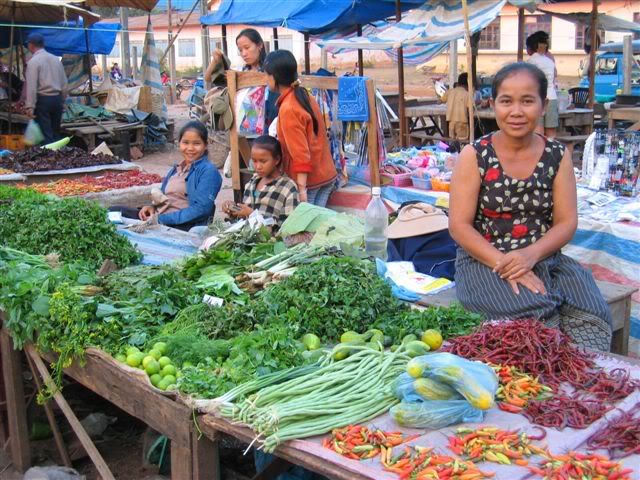
Just behind the Lao border lies Isaan, the biggest and economically poorest province of Thailand. This is nevertheless an extremely interesting place, the lack of money being compensated by a rich cultural diversity. The region was part of the Lane Xang kingdom (see "Laos: The North"), and the majority of Isaan people still speak Lao dialects. Today, it is the homeland of the best thai boxers, pop music stars, Bangkok taxi drivers, homemaids and bar girls...
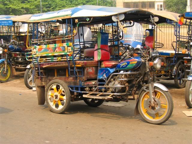
Coming from Laos, the poverty wasn't striking. Isaan even seemed relatively wealthy with large well-maintained roads, modern houses and shopping malls. We arrived at Chong Mek and went straight to Surin via Ubon Ratchathani by train. A comfortable change after a month of rough bus rides!
Unlike the rest of the province, Surin and its surroundings is more influenced by Cambodia. 70% of the people speak Cambodian and they are many Khmer ruins scattered around.
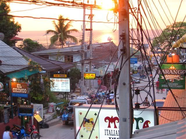
We stayed there a couple of days, enjoying the easy-going Isaan way of life at the night market, which is one of the best in the Northeast, and in the streets, where music can be heard everywhere. Not the syrupy mainstream Luk Thung (imagine Celine Dion under Valium), but the orientally funky Mor Lam (sung in Lao, combining traditional flutes with cheap keyboards), hypnotic Kantrum rock (boosted Khmer folk songs) or the more traditional Bong Lang bands (Isaan ceremonial music, dominated by percussions). Surin is also one of the best places in Thailand to shop for silk:
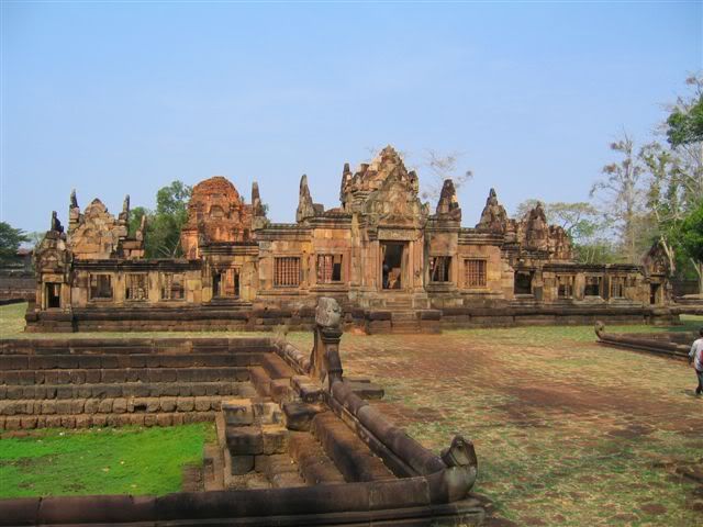
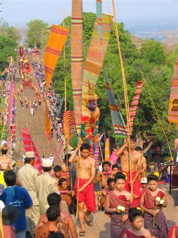
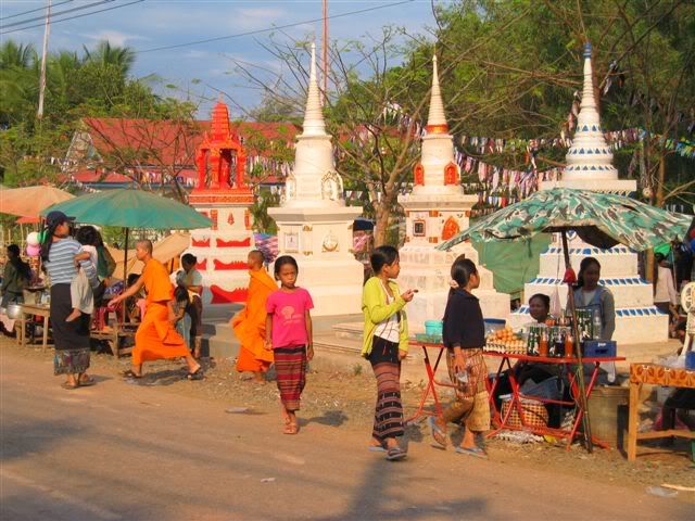
Our next stop was the small town of Nang Rong, around which are some of the most spectacular Angkorian ruins. Our timing couldn't have been better! Once a year, when the sun shines through all 15 doors of Phanong Rung, there is a festival of huge parades up the hill to the temple. A tradition believed to go back 800 years.
Bangkok and around
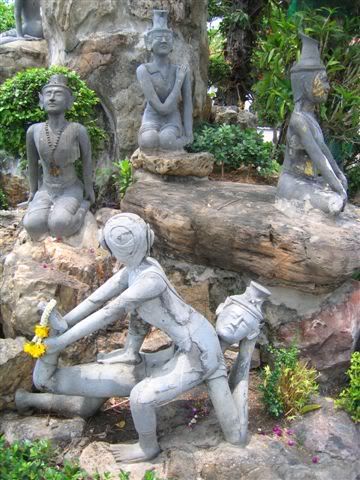
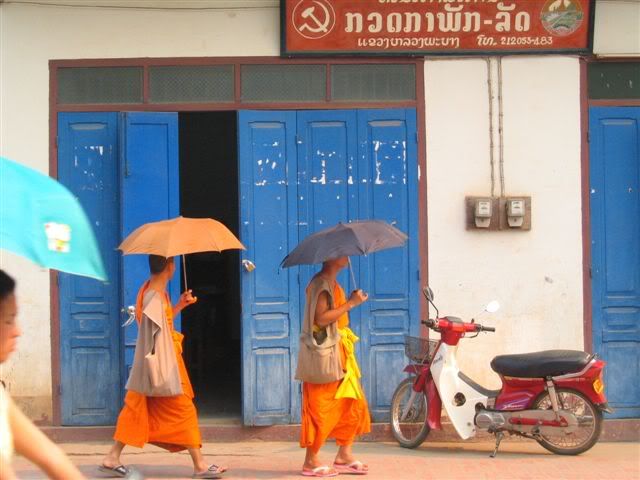
Then it was back again in Bangkok... Our bags were heavy with souvenirs and it was time to send some parcels home! After our thai massage course in Chiang Mai, we absolutely wanted to have a closer look at Wat Po temple, repository of the traditional thai massage and medicine scriptures and famous for it's huge reclining Buddha. It also had some entertaining statues demonstrating stretching positions:
Despite there still being much to see, the heat forced us out of the city. The islands were waiting for us... But on our way down, we did two more stops.
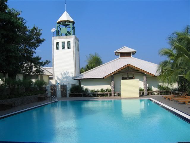
First, Amphawa near Samut Songkram. We stayed for the night in a luxurious resort for Bangkok weekenders with a wonderful pool and air-conditioned bungalows.
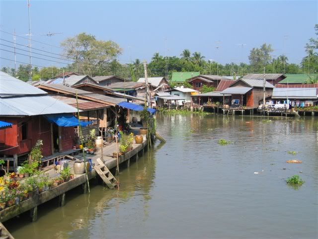
In the evening, we had a marvelous candlelight seafood meal at a restaurant on the bank of one of the rivers in the middle of nowhere. The speedboat pick-up service in the starry night lit up by fireflies was half of the romance! The next day, we visited the Amphawa district, an atmospheric Thai Venice.
Then it was Petchaburi, a nice little historical city crammed with temples.
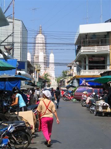
But the heat was so overwhelming we could hardly appreciate the town. The sweating started at 9 am and went on until 9 pm. It was high time for the islands!
Ko Tao
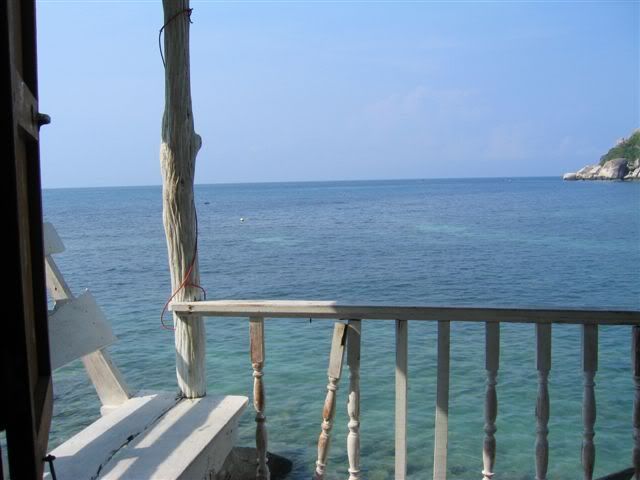
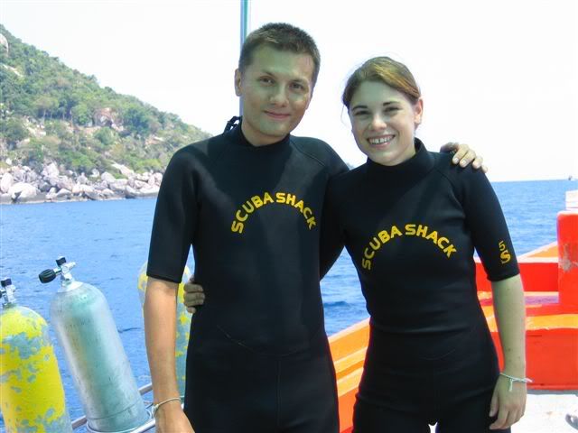
Ko Tao, meaning turtle island because of its shape, is half way down the Kra Isthmus, in the Gulf of Thailand. It is a centre for scuba dive training.
The first 6 days, we just relaxed reading and snorkeling on a uncrowded beach while the rest of Thailand was getting soaked for Songkhran, the 4-day long national new year celebration where water is thrown at each other as blessing.
Then we did some serious diving! Claudia studied for her PADI certifications (up to advanced open water diver) while Gilbert did some fun dives. Underwater life was interesting enough, with plenty of colourful fish and soft corals.
But after 2 weeks of beach life in a very traveller oriented place (meaning both thai and western food were too often bland and expensive caricatures of the real thing), and despite us meeting some very nice and interesting people, the urge of discovering new horizons pulled us back on the road... direction Malaysia!
Isaan
Just behind the Lao border lies Isaan, the biggest and economically poorest province of Thailand. This is nevertheless an extremely interesting place, the lack of money being compensated by a rich cultural diversity. The region was part of the Lane Xang kingdom (see "Laos: The North"), and the majority of Isaan people still speak Lao dialects. Today, it is the homeland of the best thai boxers, pop music stars, Bangkok taxi drivers, homemaids and bar girls...
Coming from Laos, the poverty wasn't striking. Isaan even seemed relatively wealthy with large well-maintained roads, modern houses and shopping malls. We arrived at Chong Mek and went straight to Surin via Ubon Ratchathani by train. A comfortable change after a month of rough bus rides!
Unlike the rest of the province, Surin and its surroundings is more influenced by Cambodia. 70% of the people speak Cambodian and they are many Khmer ruins scattered around.
We stayed there a couple of days, enjoying the easy-going Isaan way of life at the night market, which is one of the best in the Northeast, and in the streets, where music can be heard everywhere. Not the syrupy mainstream Luk Thung (imagine Celine Dion under Valium), but the orientally funky Mor Lam (sung in Lao, combining traditional flutes with cheap keyboards), hypnotic Kantrum rock (boosted Khmer folk songs) or the more traditional Bong Lang bands (Isaan ceremonial music, dominated by percussions). Surin is also one of the best places in Thailand to shop for silk:
Our next stop was the small town of Nang Rong, around which are some of the most spectacular Angkorian ruins. Our timing couldn't have been better! Once a year, when the sun shines through all 15 doors of Phanong Rung, there is a festival of huge parades up the hill to the temple. A tradition believed to go back 800 years.
Bangkok and around
Then it was back again in Bangkok... Our bags were heavy with souvenirs and it was time to send some parcels home! After our thai massage course in Chiang Mai, we absolutely wanted to have a closer look at Wat Po temple, repository of the traditional thai massage and medicine scriptures and famous for it's huge reclining Buddha. It also had some entertaining statues demonstrating stretching positions:
Despite there still being much to see, the heat forced us out of the city. The islands were waiting for us... But on our way down, we did two more stops.
First, Amphawa near Samut Songkram. We stayed for the night in a luxurious resort for Bangkok weekenders with a wonderful pool and air-conditioned bungalows.
In the evening, we had a marvelous candlelight seafood meal at a restaurant on the bank of one of the rivers in the middle of nowhere. The speedboat pick-up service in the starry night lit up by fireflies was half of the romance! The next day, we visited the Amphawa district, an atmospheric Thai Venice.
Then it was Petchaburi, a nice little historical city crammed with temples.
But the heat was so overwhelming we could hardly appreciate the town. The sweating started at 9 am and went on until 9 pm. It was high time for the islands!
Ko Tao
Ko Tao, meaning turtle island because of its shape, is half way down the Kra Isthmus, in the Gulf of Thailand. It is a centre for scuba dive training.
The first 6 days, we just relaxed reading and snorkeling on a uncrowded beach while the rest of Thailand was getting soaked for Songkhran, the 4-day long national new year celebration where water is thrown at each other as blessing.
Then we did some serious diving! Claudia studied for her PADI certifications (up to advanced open water diver) while Gilbert did some fun dives. Underwater life was interesting enough, with plenty of colourful fish and soft corals.
But after 2 weeks of beach life in a very traveller oriented place (meaning both thai and western food were too often bland and expensive caricatures of the real thing), and despite us meeting some very nice and interesting people, the urge of discovering new horizons pulled us back on the road... direction Malaysia!
Friday, March 18, 2005
Laos: The South
Southern Laos is quite different from the North. The climate is much warmer and even more patience is required when travelling around. It can get relaxed to the point of apathy! A typical bus journey involves stops at virtually every house and market on the way... Maybe to make sure that nobody was forgotten and no stomach is starving.
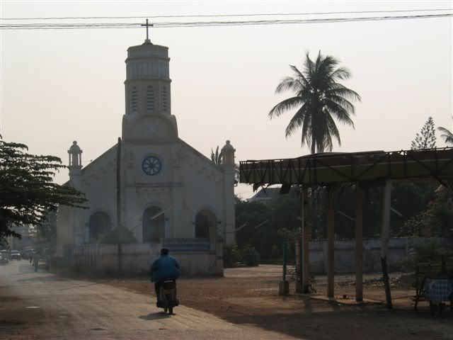
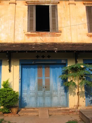
The lowlands along the large Mekong valley are mostly populated by Lao people, who account for only 30% of Laos' population. During the colonial period, the French established themselves in many cities there, leaving behind a few french speaking locals and some buildings. The village square and church in the centre of Savannakhet are a particularly striking example.
...a facade:
Further south, Pakse is the gateway to the 4000 islands and the Bolaven plateau. The city itself has a few colonial houses, but is nothing special. On our way, we had to stop there a couple of times.
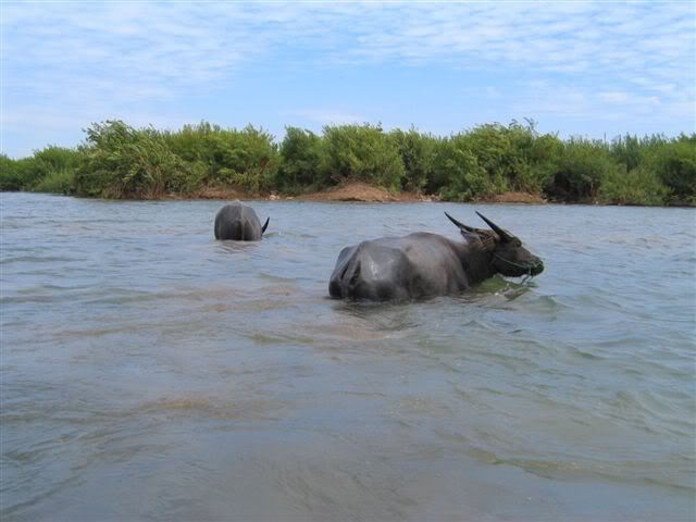
In the most southern part of Laos, the Mekong formed a maze of small islands. The area is called Sipandon, meaning 4000 islands (but there are maybe less...). At this time of the year, it gets very hot and even buffalos prefer staying in the water!
We first spent a couple of days on Don Khong, the biggest (14 km long) and most northern island. Getting around by bike took us the whole day, with a 2 hour break in a rice field hut to avoid a bad sunburn...
After this, we took a longboat down to Don Det, a backpacker island where nearly every farmer has set up bungalows to rent. The effects of this start to appear (overpricing and lazy service). Fortunately, there is still very little electricity, so it is quiet and peaceful.
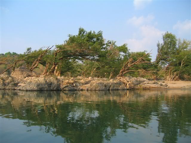
...trees bent by the river during the wet season:
Swimming in the river was agreable, and there was enough to see to keep us busy on bikes for a day: rapids, a nice cove, the remains of the only railway in Laos (built by the French to transport goods past the aformentioned rapids). And in the evening, from an island on the Cambodian border, we were lucky to spot some of the last Irrawady dolphins (or, to be more precise their back fins!).
After the islands, we went to Kiet Ngong, a little visited village at the foot of the mountains with none of the modern facilities (no electricity, no running water, no karaoke!). The people there breed elephants, and it was an ideal location for a ride on one of those pachyderms. Laos being sometimes called "Land of Million Elephants", we couldn't very well leave the country without doing it! So Ong, a placid young male, carried us up and down Asa hill in about 1h30, occasionally spraying us and his master with a slimy substance and farting loudly...
In the evening, our hosts kindly served us a soup of tough chicken (who certainly had a long and happy life). We slept in a hut outside the village from where we had a fantastic view on a plain where elephants grazed.
We then went up to the Bolaven plateau, which is renowned for its coffee and waterfalls. But we were mostly attracted by the Mon-Khmer ethnic minorities who make up for the majority of the population there. Although also animists and living in mountainous areas, they are quite different from the Northern hilltribes, who are usually of Sino-Tibetans or Tibetan-Burmese origin.
We did see many non-Lao people (Nge, Laven, Katu, Alaks), but as they only wear their traditional clothes for special occasions, they didn't stand out as much as in the North. Some villages are still organised around a big place bearing a large spirit house, but they tend to be replaced by Lao looking settlements along the main roads where people are encouraged by the government to move to get better access to electricity, schools, hospitals, markets, etc.
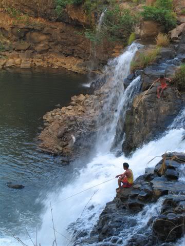
We stopped in Tat Lo for a night, from where we walked to a Nge village and the waterfall. It was a good place to hang out for a day, but, like Don Det, it is getting irritatingly touristy.
In hope to see more authentic life, we travelled further to Salavan and Sekong. Both towns are near the Ho Chi Minh Trail, and have been heavily bombed by the US during the Vietnam war. Like in Phonsavan, unexploded bombs are still a big problem here. Tigers do also roam the surrounding jungle.
In Salavan, the market with wild food (insects, iguanas, bats, snakes) was quite interesting. But it was the everyday life and atmosphere we liked most. In the evening, incredibly loud "maw lam" bands played at wedding parties and could be heard all over town.
Sekong looked even more remote than Salavan. Dusty roads, a couple of good handicraft shops and a haunted hotel. We got some traditional Nge and Katu weavings with motifs ranging from elephants to helicopters. Maybe the beginning of a new cargo cult. In any case, the ghosts of the war will still be haunting the area for a long time...
After this, it was back to Pakse for some shopping and the border crossing to Thailand at Vang Tao/Chong Mek.
The lowlands along the large Mekong valley are mostly populated by Lao people, who account for only 30% of Laos' population. During the colonial period, the French established themselves in many cities there, leaving behind a few french speaking locals and some buildings. The village square and church in the centre of Savannakhet are a particularly striking example.
...a facade:
Further south, Pakse is the gateway to the 4000 islands and the Bolaven plateau. The city itself has a few colonial houses, but is nothing special. On our way, we had to stop there a couple of times.
In the most southern part of Laos, the Mekong formed a maze of small islands. The area is called Sipandon, meaning 4000 islands (but there are maybe less...). At this time of the year, it gets very hot and even buffalos prefer staying in the water!
We first spent a couple of days on Don Khong, the biggest (14 km long) and most northern island. Getting around by bike took us the whole day, with a 2 hour break in a rice field hut to avoid a bad sunburn...
After this, we took a longboat down to Don Det, a backpacker island where nearly every farmer has set up bungalows to rent. The effects of this start to appear (overpricing and lazy service). Fortunately, there is still very little electricity, so it is quiet and peaceful.
...trees bent by the river during the wet season:
Swimming in the river was agreable, and there was enough to see to keep us busy on bikes for a day: rapids, a nice cove, the remains of the only railway in Laos (built by the French to transport goods past the aformentioned rapids). And in the evening, from an island on the Cambodian border, we were lucky to spot some of the last Irrawady dolphins (or, to be more precise their back fins!).
After the islands, we went to Kiet Ngong, a little visited village at the foot of the mountains with none of the modern facilities (no electricity, no running water, no karaoke!). The people there breed elephants, and it was an ideal location for a ride on one of those pachyderms. Laos being sometimes called "Land of Million Elephants", we couldn't very well leave the country without doing it! So Ong, a placid young male, carried us up and down Asa hill in about 1h30, occasionally spraying us and his master with a slimy substance and farting loudly...
In the evening, our hosts kindly served us a soup of tough chicken (who certainly had a long and happy life). We slept in a hut outside the village from where we had a fantastic view on a plain where elephants grazed.
We then went up to the Bolaven plateau, which is renowned for its coffee and waterfalls. But we were mostly attracted by the Mon-Khmer ethnic minorities who make up for the majority of the population there. Although also animists and living in mountainous areas, they are quite different from the Northern hilltribes, who are usually of Sino-Tibetans or Tibetan-Burmese origin.
We did see many non-Lao people (Nge, Laven, Katu, Alaks), but as they only wear their traditional clothes for special occasions, they didn't stand out as much as in the North. Some villages are still organised around a big place bearing a large spirit house, but they tend to be replaced by Lao looking settlements along the main roads where people are encouraged by the government to move to get better access to electricity, schools, hospitals, markets, etc.
We stopped in Tat Lo for a night, from where we walked to a Nge village and the waterfall. It was a good place to hang out for a day, but, like Don Det, it is getting irritatingly touristy.
In hope to see more authentic life, we travelled further to Salavan and Sekong. Both towns are near the Ho Chi Minh Trail, and have been heavily bombed by the US during the Vietnam war. Like in Phonsavan, unexploded bombs are still a big problem here. Tigers do also roam the surrounding jungle.
In Salavan, the market with wild food (insects, iguanas, bats, snakes) was quite interesting. But it was the everyday life and atmosphere we liked most. In the evening, incredibly loud "maw lam" bands played at wedding parties and could be heard all over town.
Sekong looked even more remote than Salavan. Dusty roads, a couple of good handicraft shops and a haunted hotel. We got some traditional Nge and Katu weavings with motifs ranging from elephants to helicopters. Maybe the beginning of a new cargo cult. In any case, the ghosts of the war will still be haunting the area for a long time...
After this, it was back to Pakse for some shopping and the border crossing to Thailand at Vang Tao/Chong Mek.
Monday, March 14, 2005
Laos: The Capital
Vientiane is a small city of just over 200'000 inhabitants. It is nevertheless the biggest in Laos, a rural country the size of Great Britain with only 6 million people.
If capitals reflect nations' ambitions, then Vientiane says a lot about Laos...
The place is very laid back, with hardly the activity of a provincial town. Beside the unguarded official buildings, a relatively strong foreign presence can be felt through NGOs and joint venture companies. Hardly any bigger project (cultural, touristic, demining, logging, infrastrucuture construction, etc) in Laos seems to be running without some foreign investment.
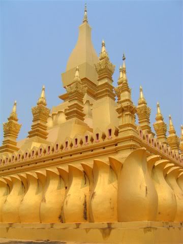
The Patuxai (a half finished concrete "arc de triomphe") and the golden Pha That Luang chedi are the main landmarks of Vientiane.
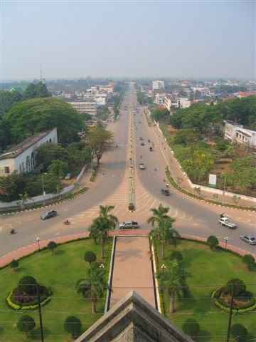
The construction of the former was started by the royalists in the 1960's, but interupted by the war. The communists, who took the power in 1975, never bothered finishing it. But it is still makes an excellent viewpoint!
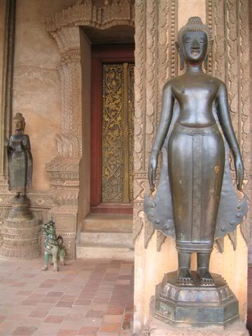
...a typical Lao standing Buddah with it's upwards curved robe:
Besides, a good selection of cafes and restaurants serving Laos specialities such as stuffed frog (bony but delicious!) and grilled Mekong fish, and an excellent traditional herbal sauna/massage hut in the Sok Pa Luang temple compound made our 3 days stay most enjoyable!
If capitals reflect nations' ambitions, then Vientiane says a lot about Laos...
The place is very laid back, with hardly the activity of a provincial town. Beside the unguarded official buildings, a relatively strong foreign presence can be felt through NGOs and joint venture companies. Hardly any bigger project (cultural, touristic, demining, logging, infrastrucuture construction, etc) in Laos seems to be running without some foreign investment.
The Patuxai (a half finished concrete "arc de triomphe") and the golden Pha That Luang chedi are the main landmarks of Vientiane.
The construction of the former was started by the royalists in the 1960's, but interupted by the war. The communists, who took the power in 1975, never bothered finishing it. But it is still makes an excellent viewpoint!
...a typical Lao standing Buddah with it's upwards curved robe:
Besides, a good selection of cafes and restaurants serving Laos specialities such as stuffed frog (bony but delicious!) and grilled Mekong fish, and an excellent traditional herbal sauna/massage hut in the Sok Pa Luang temple compound made our 3 days stay most enjoyable!
Wednesday, March 02, 2005
Laos: The North
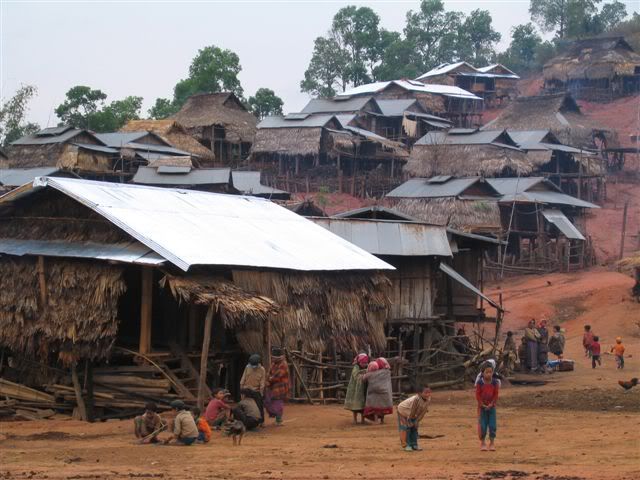
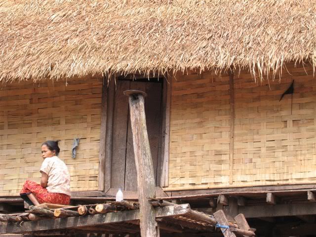
Northern Laos is a sleepy mountainous area with an amazing number of ethnic minorities. The remoteness of the area has helped them to preserve their cultures and traditions. Many colourfully dressed women can be seen at the markets, and the buddhist temples and forests are full of animist signs. Travel up there is slow, but the bus journeys across the quaint minority villages and wild landscapes are often as interesting as the stops.
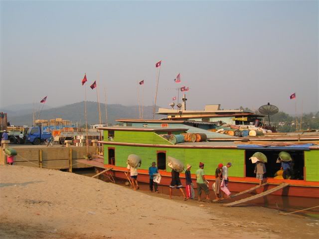
We entered Laos from Thailand by crossing the Mekong river to Huay Xai, a small and busy border town. Lao cargo boats in Chiang Khong, on the thai side of the border:
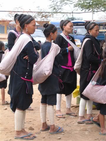
From there, we directly proceeded with a 9 hours bus ride on the unsealed route no3 to the small northwestern Luang Nam Tha province, which boasts around 30 ethnies. Before getting further, we had to stay overnight at Luang Nam Tha, the provincial capital, which, with it's lack of public lighting, looked more like a ghost town. Lenten women at the bus station:
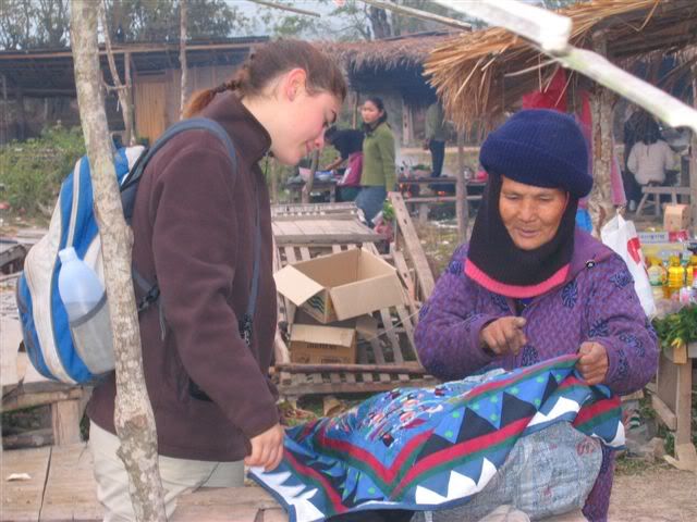
Our first planned stop was Muang Sing, which used to be the biggest centre for opium trade in the Golden Triangle. But nowadays, the market only has legal products and the poppy fields have moved further into the valleys, far from the main roads and the government officials. Internationally funded programs help the villages improve their infrastructure and find alternative sources of revenue. A Hmong woman selling handicraft to a tourist on the morning market...
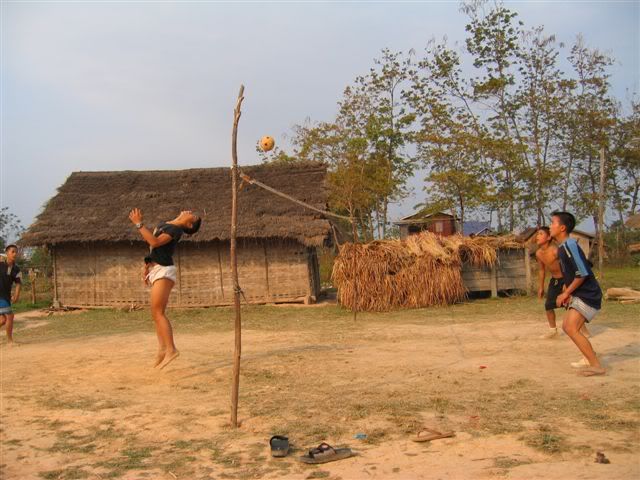
Children playing kataw (kind of foot-volley-ball) in a backyard:
Around Muang Sing, they are many Akha, Hmong, Yao, Thai Neua, and Thai Lu villages. With 2 guides and 3 other travellers, we did an excursion there and stayed for the night in Pawai Kao, an Akha village, where we were warmly greeted with a glass of Lao-Lao (rice wine) and a massage, in accordance with the tradition! Of all the hilltribes, the Akhas are those who most firmly follow their animistic way of life (the Akhazan).
In an effort to minimise the negative impact of tourism, the local trekking company limits the number of excursions and visitors to those places (once a week for a maximum of 6 people in the case of Pawai Kao). But, as they are not so many travellers in the region, the limits are not always reached.
After Muang Sing, we went down to Pak Beng to take a boat to Luang Prabang. It took 2 days by bus to reach Pak Beng, and we had to stay overnight in Udomxai, an unremarkable city from where the chinese built roads of the north radiate. With the planned increase of trade with nearby Yunnan, this town is supposed to grow rapidly in the next years. Unsurprisingly, a strong chinese presence can be felt in Udomxai.
On the way, in the Nam Beng valley:
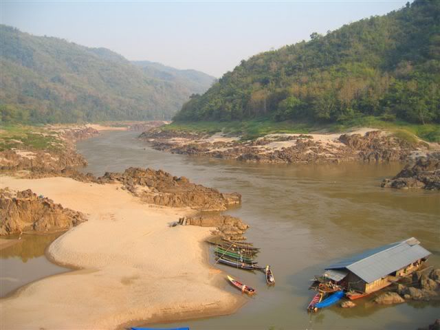
The scenery on the boat trip from Pak Beng to Luang Prabang didn't disappoint us! The 2 days bus trip to Pak Beng was definetly worth it. It took the slow boat 8 hours meandering through rock formations and sand banks to reach Luang Prabang. View of the Mekong in Pak Beng:
Luang Prabang was the first capital of Lane Xang, the first (and last!) powerful Lao kingdom. It occupied today's Laos and parts of Thailand (the Isan province). Lane Xang had its golden age in the 14-17 centuries. After this, foreign powers (Burma, Siam, France) imposed their rule over Laos until the independance in 1953.
Luang Prabang has kept a strong french colonial touch in the buildings, palaces, cafes... Having lost its political power to Vientiane, the atmosphere stayed very laid back and it didn't undergo much changes since the colonial era.
The UNESCO acknowledged Luang Prabang as one of the best preserved old towns in South-East, and put it on the World Cultural Heritage list in 1995. Since then, it has become the main tourist magnet of Laos. But the flow of visitors is still acceptable.
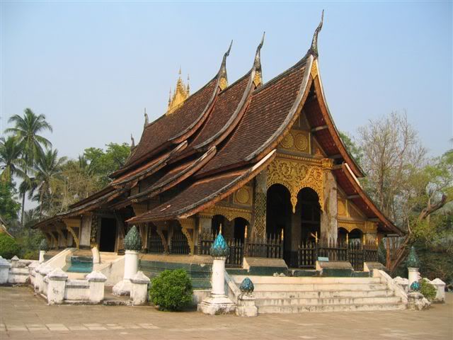
Wat Xieng Thong, an archetypal Luang Prabang style temple:
We finished our tour of northern Laos in Phonsavan, in the Xieng Khuang province. A stronghold of the Pathet Lao during the Second Indochina War, this province was carpet-bombed by the USA in a frightening display of fanatism. Between 1964 - 1973, more bombs were dropped over Laos than over Germany and Japan during the Second World War, killing one third of the population.
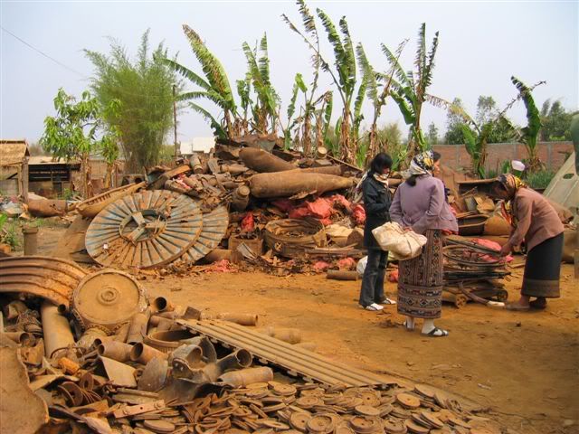
Traces can still be seen today everywhere in the area. Unexploded ordonnances still claim over 1000 lifes a year in Laos, mostly children who play with the tennis ball sized cluster bomb "bombies" and farmers tilling their land. A metal scrapyard in Phonsavan:
But we didn't come to this area just to see remnants of the war... The main attraction of Phonsavan is the nearby Plain of Jars.
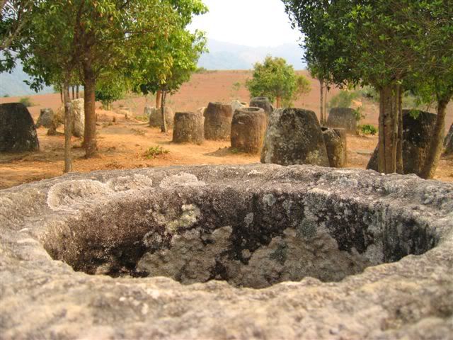
The origin and purpose of those big sandstone urns is still quite mysterious. They are probably 4000 years old. Other smaller sites with similar, but less monumental and cruder jars have been found in Assam (India), Burma and Sulawesi (Indonesia). One of the theories is that they were made by Austro-asian people, who migrated from India over Burma to Laos and then ended in Indonesia. The jars might have been used as repositories for ritual offerings.
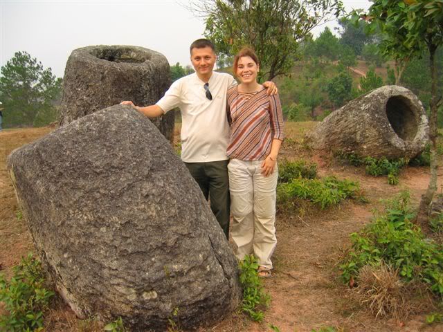
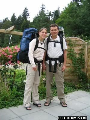
Here a picture of us for our parents!
We entered Laos from Thailand by crossing the Mekong river to Huay Xai, a small and busy border town. Lao cargo boats in Chiang Khong, on the thai side of the border:
From there, we directly proceeded with a 9 hours bus ride on the unsealed route no3 to the small northwestern Luang Nam Tha province, which boasts around 30 ethnies. Before getting further, we had to stay overnight at Luang Nam Tha, the provincial capital, which, with it's lack of public lighting, looked more like a ghost town. Lenten women at the bus station:
Our first planned stop was Muang Sing, which used to be the biggest centre for opium trade in the Golden Triangle. But nowadays, the market only has legal products and the poppy fields have moved further into the valleys, far from the main roads and the government officials. Internationally funded programs help the villages improve their infrastructure and find alternative sources of revenue. A Hmong woman selling handicraft to a tourist on the morning market...
Children playing kataw (kind of foot-volley-ball) in a backyard:
Around Muang Sing, they are many Akha, Hmong, Yao, Thai Neua, and Thai Lu villages. With 2 guides and 3 other travellers, we did an excursion there and stayed for the night in Pawai Kao, an Akha village, where we were warmly greeted with a glass of Lao-Lao (rice wine) and a massage, in accordance with the tradition! Of all the hilltribes, the Akhas are those who most firmly follow their animistic way of life (the Akhazan).
In an effort to minimise the negative impact of tourism, the local trekking company limits the number of excursions and visitors to those places (once a week for a maximum of 6 people in the case of Pawai Kao). But, as they are not so many travellers in the region, the limits are not always reached.
After Muang Sing, we went down to Pak Beng to take a boat to Luang Prabang. It took 2 days by bus to reach Pak Beng, and we had to stay overnight in Udomxai, an unremarkable city from where the chinese built roads of the north radiate. With the planned increase of trade with nearby Yunnan, this town is supposed to grow rapidly in the next years. Unsurprisingly, a strong chinese presence can be felt in Udomxai.
On the way, in the Nam Beng valley:
The scenery on the boat trip from Pak Beng to Luang Prabang didn't disappoint us! The 2 days bus trip to Pak Beng was definetly worth it. It took the slow boat 8 hours meandering through rock formations and sand banks to reach Luang Prabang. View of the Mekong in Pak Beng:
Luang Prabang was the first capital of Lane Xang, the first (and last!) powerful Lao kingdom. It occupied today's Laos and parts of Thailand (the Isan province). Lane Xang had its golden age in the 14-17 centuries. After this, foreign powers (Burma, Siam, France) imposed their rule over Laos until the independance in 1953.
Luang Prabang has kept a strong french colonial touch in the buildings, palaces, cafes... Having lost its political power to Vientiane, the atmosphere stayed very laid back and it didn't undergo much changes since the colonial era.
The UNESCO acknowledged Luang Prabang as one of the best preserved old towns in South-East, and put it on the World Cultural Heritage list in 1995. Since then, it has become the main tourist magnet of Laos. But the flow of visitors is still acceptable.
Wat Xieng Thong, an archetypal Luang Prabang style temple:
We finished our tour of northern Laos in Phonsavan, in the Xieng Khuang province. A stronghold of the Pathet Lao during the Second Indochina War, this province was carpet-bombed by the USA in a frightening display of fanatism. Between 1964 - 1973, more bombs were dropped over Laos than over Germany and Japan during the Second World War, killing one third of the population.
Traces can still be seen today everywhere in the area. Unexploded ordonnances still claim over 1000 lifes a year in Laos, mostly children who play with the tennis ball sized cluster bomb "bombies" and farmers tilling their land. A metal scrapyard in Phonsavan:
But we didn't come to this area just to see remnants of the war... The main attraction of Phonsavan is the nearby Plain of Jars.
The origin and purpose of those big sandstone urns is still quite mysterious. They are probably 4000 years old. Other smaller sites with similar, but less monumental and cruder jars have been found in Assam (India), Burma and Sulawesi (Indonesia). One of the theories is that they were made by Austro-asian people, who migrated from India over Burma to Laos and then ended in Indonesia. The jars might have been used as repositories for ritual offerings.
Here a picture of us for our parents!
![]()