Friday, March 18, 2005
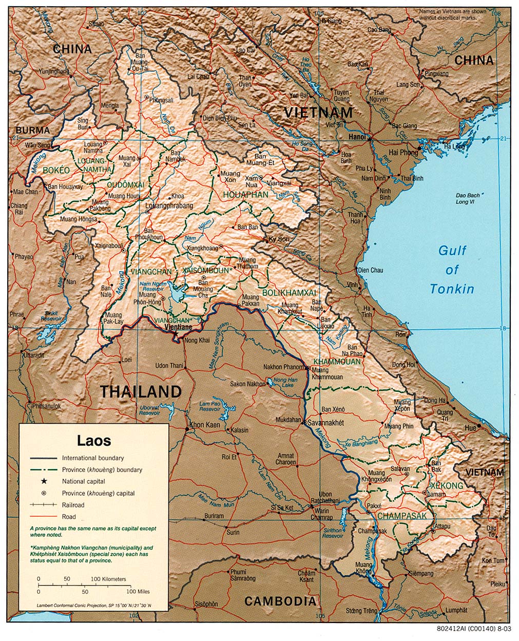
Laos: The South
Southern Laos is quite different from the North. The climate is much warmer and even more patience is required when travelling around. It can get relaxed to the point of apathy! A typical bus journey involves stops at virtually every house and market on the way... Maybe to make sure that nobody was forgotten and no stomach is starving.
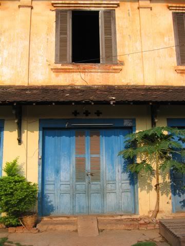
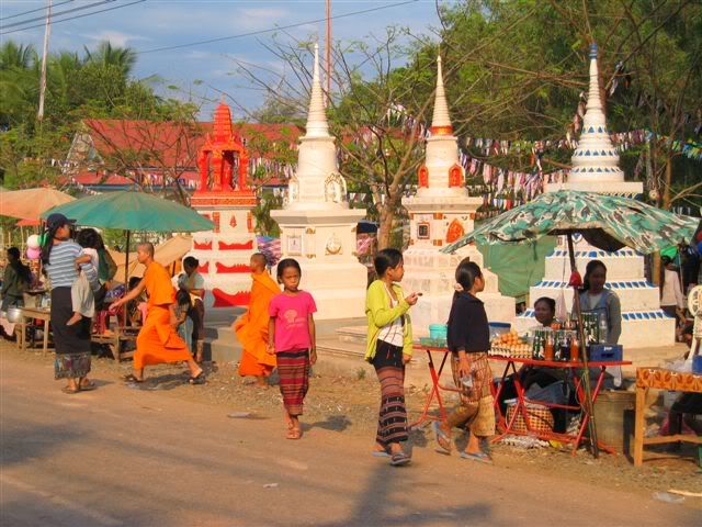
The lowlands along the large Mekong valley are mostly populated by Lao people, who account for only 30% of Laos' population. During the colonial period, the French established themselves in many cities there, leaving behind a few french speaking locals and some buildings. The village square and church in the centre of Savannakhet are a particularly striking example.
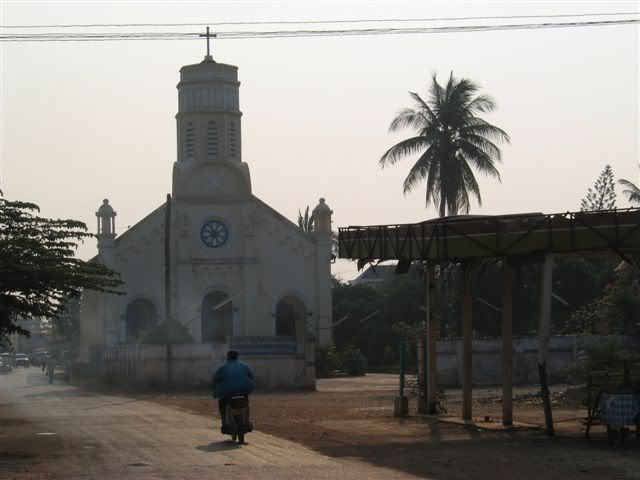
...a facade:
Further south, Pakse is the gateway to the 4000 islands and the Bolaven plateau. The city itself has a few colonial houses, but is nothing special. On our way, we had to stop there a couple of times.
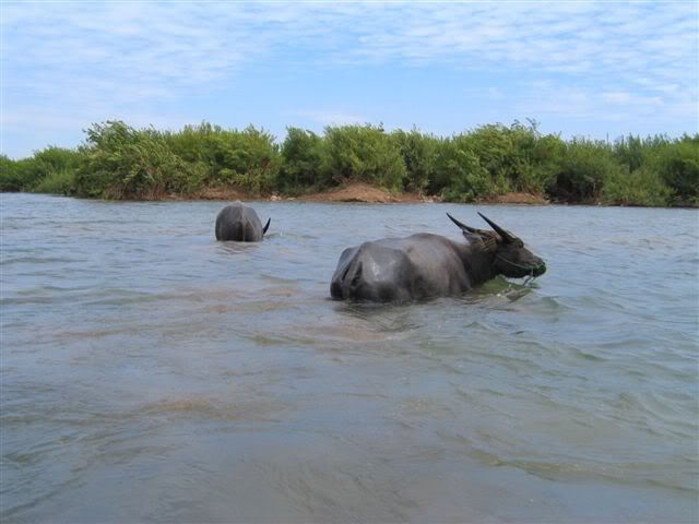
In the most southern part of Laos, the Mekong formed a maze of small islands. The area is called Sipandon, meaning 4000 islands (but there are maybe less...). At this time of the year, it gets very hot and even buffalos prefer staying in the water!
We first spent a couple of days on Don Khong, the biggest (14 km long) and most northern island. Getting around by bike took us the whole day, with a 2 hour break in a rice field hut to avoid a bad sunburn...
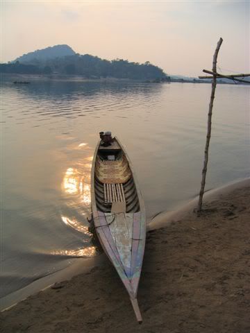
After this, we took a longboat down to Don Det, a backpacker island where nearly every farmer has set up bungalows to rent. The effects of this start to appear (overpricing and lazy service). Fortunately, there is still very little electricity, so it is quiet and peaceful.
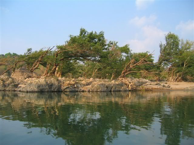
...trees bent by the river during the wet season:
Swimming in the river was agreable, and there was enough to see to keep us busy on bikes for a day: rapids, a nice cove, the remains of the only railway in Laos (built by the French to transport goods past the aformentioned rapids). And in the evening, from an island on the Cambodian border, we were lucky to spot some of the last Irrawady dolphins (or, to be more precise their back fins!).
After the islands, we went to Kiet Ngong, a little visited village at the foot of the mountains with none of the modern facilities (no electricity, no running water, no karaoke!). The people there breed elephants, and it was an ideal location for a ride on one of those pachyderms. Laos being sometimes called "Land of Million Elephants", we couldn't very well leave the country without doing it! So Ong, a placid young male, carried us up and down Asa hill in about 1h30, occasionally spraying us and his master with a slimy substance and farting loudly...
In the evening, our hosts kindly served us a soup of tough chicken (who certainly had a long and happy life). We slept in a hut outside the village from where we had a fantastic view on a plain where elephants grazed.
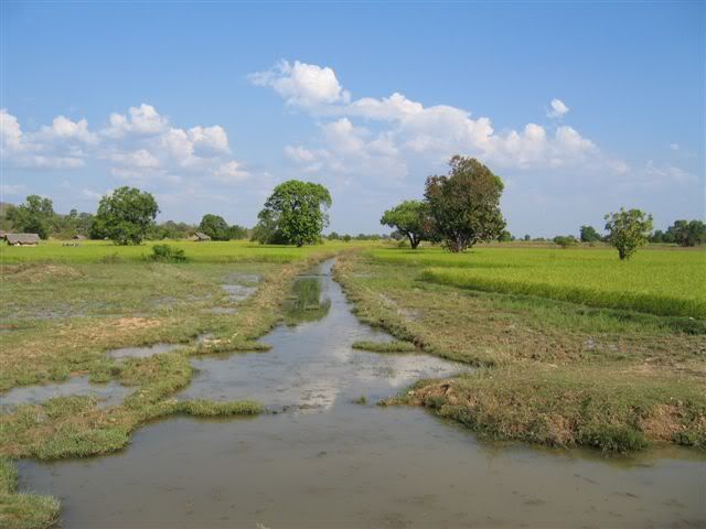
We then went up to the Bolaven plateau, which is renowned for its coffee and waterfalls. But we were mostly attracted by the Mon-Khmer ethnic minorities who make up for the majority of the population there. Although also animists and living in mountainous areas, they are quite different from the Northern hilltribes, who are usually of Sino-Tibetans or Tibetan-Burmese origin.
We did see many non-Lao people (Nge, Laven, Katu, Alaks), but as they only wear their traditional clothes for special occasions, they didn't stand out as much as in the North. Some villages are still organised around a big place bearing a large spirit house, but they tend to be replaced by Lao looking settlements along the main roads where people are encouraged by the government to move to get better access to electricity, schools, hospitals, markets, etc.
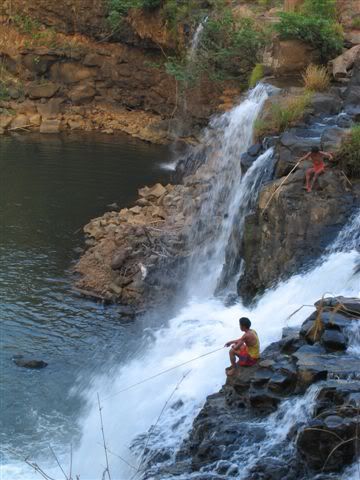
We stopped in Tat Lo for a night, from where we walked to a Nge village and the waterfall. It was a good place to hang out for a day, but, like Don Det, it is getting irritatingly touristy.
In hope to see more authentic life, we travelled further to Salavan and Sekong. Both towns are near the Ho Chi Minh Trail, and have been heavily bombed by the US during the Vietnam war. Like in Phonsavan, unexploded bombs are still a big problem here. Tigers do also roam the surrounding jungle.
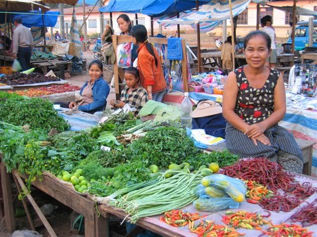
In Salavan, the market with wild food (insects, iguanas, bats, snakes) was quite interesting. But it was the everyday life and atmosphere we liked most. In the evening, incredibly loud "maw lam" bands played at wedding parties and could be heard all over town.
Sekong looked even more remote than Salavan. Dusty roads, a couple of good handicraft shops and a haunted hotel. We got some traditional Nge and Katu weavings with motifs ranging from elephants to helicopters. Maybe the beginning of a new cargo cult. In any case, the ghosts of the war will still be haunting the area for a long time...
After this, it was back to Pakse for some shopping and the border crossing to Thailand at Vang Tao/Chong Mek.
The lowlands along the large Mekong valley are mostly populated by Lao people, who account for only 30% of Laos' population. During the colonial period, the French established themselves in many cities there, leaving behind a few french speaking locals and some buildings. The village square and church in the centre of Savannakhet are a particularly striking example.
...a facade:
Further south, Pakse is the gateway to the 4000 islands and the Bolaven plateau. The city itself has a few colonial houses, but is nothing special. On our way, we had to stop there a couple of times.
In the most southern part of Laos, the Mekong formed a maze of small islands. The area is called Sipandon, meaning 4000 islands (but there are maybe less...). At this time of the year, it gets very hot and even buffalos prefer staying in the water!
We first spent a couple of days on Don Khong, the biggest (14 km long) and most northern island. Getting around by bike took us the whole day, with a 2 hour break in a rice field hut to avoid a bad sunburn...
After this, we took a longboat down to Don Det, a backpacker island where nearly every farmer has set up bungalows to rent. The effects of this start to appear (overpricing and lazy service). Fortunately, there is still very little electricity, so it is quiet and peaceful.
...trees bent by the river during the wet season:
Swimming in the river was agreable, and there was enough to see to keep us busy on bikes for a day: rapids, a nice cove, the remains of the only railway in Laos (built by the French to transport goods past the aformentioned rapids). And in the evening, from an island on the Cambodian border, we were lucky to spot some of the last Irrawady dolphins (or, to be more precise their back fins!).
After the islands, we went to Kiet Ngong, a little visited village at the foot of the mountains with none of the modern facilities (no electricity, no running water, no karaoke!). The people there breed elephants, and it was an ideal location for a ride on one of those pachyderms. Laos being sometimes called "Land of Million Elephants", we couldn't very well leave the country without doing it! So Ong, a placid young male, carried us up and down Asa hill in about 1h30, occasionally spraying us and his master with a slimy substance and farting loudly...
In the evening, our hosts kindly served us a soup of tough chicken (who certainly had a long and happy life). We slept in a hut outside the village from where we had a fantastic view on a plain where elephants grazed.
We then went up to the Bolaven plateau, which is renowned for its coffee and waterfalls. But we were mostly attracted by the Mon-Khmer ethnic minorities who make up for the majority of the population there. Although also animists and living in mountainous areas, they are quite different from the Northern hilltribes, who are usually of Sino-Tibetans or Tibetan-Burmese origin.
We did see many non-Lao people (Nge, Laven, Katu, Alaks), but as they only wear their traditional clothes for special occasions, they didn't stand out as much as in the North. Some villages are still organised around a big place bearing a large spirit house, but they tend to be replaced by Lao looking settlements along the main roads where people are encouraged by the government to move to get better access to electricity, schools, hospitals, markets, etc.
We stopped in Tat Lo for a night, from where we walked to a Nge village and the waterfall. It was a good place to hang out for a day, but, like Don Det, it is getting irritatingly touristy.
In hope to see more authentic life, we travelled further to Salavan and Sekong. Both towns are near the Ho Chi Minh Trail, and have been heavily bombed by the US during the Vietnam war. Like in Phonsavan, unexploded bombs are still a big problem here. Tigers do also roam the surrounding jungle.
In Salavan, the market with wild food (insects, iguanas, bats, snakes) was quite interesting. But it was the everyday life and atmosphere we liked most. In the evening, incredibly loud "maw lam" bands played at wedding parties and could be heard all over town.
Sekong looked even more remote than Salavan. Dusty roads, a couple of good handicraft shops and a haunted hotel. We got some traditional Nge and Katu weavings with motifs ranging from elephants to helicopters. Maybe the beginning of a new cargo cult. In any case, the ghosts of the war will still be haunting the area for a long time...
After this, it was back to Pakse for some shopping and the border crossing to Thailand at Vang Tao/Chong Mek.
![]()